
Walk a Fayette County Street
A useful street-by-street search separates ownership from occupancy. The Fayette Property Valuation Administrator identifies the parcel and tax-date owner. LFUCG GIS fixes that parcel on the block. The Fayette County Clerk then supplies recorded transfers, while voter and library sources add narrower evidence about people connected to an address. Each step has a different keeper and a different limit.
- Enter the exact number, street, and unit in the Fayette PVA property search. Save the situs, parcel number, owner, legal description, and deed book/page.
- Open the same location in the LFUCG property GIS service. Confirm the parcel polygon and collect nearby PVANUM identifiers.
- Use Fayette Deeds with the address, book/page, and party names. Follow the current deed before widening the search.
- Check permits, code orders, and tax events by address. These date work or official action, but do not prove who slept at the property.
- For an older occupant, use Lexington Public Library street and telephone directories. For a known current voter, use the state confirmation tool with name and birth date.
The same process works across a long road, but each parcel must be opened on its own. Condo units, rear lots, alleys, and common areas can share similar labels. A whole-street result is only as sound as its parcel-by-parcel checks.
Fayette Street Directory PVA Fields
The PVA card is the strongest first stop for a current address. Fayette County assesses real property as of January 1, so the named tax-date owner can differ from someone who bought later. The public quick search accepts an address. Its full live filter screen was not available during research, so only verified card fields belong in a search plan.
| Field | What to retain | Why it matters by address |
|---|---|---|
| Owner / January 1 owner | Exact names and date context | Names the assessment owner, not every resident |
| Mailing address | Owner correspondence address | May be outside Fayette County |
| Situs / location | Physical street address | Matches the mapped property |
| Parcel and legal description | PVANUM, lot, block, subdivision | Survives address spelling changes |
| Sales history | Date, price, deed book/page, prior owner | Bridges the parcel to Fayette Deeds |
| Improvements | Units, year built, size, sketch | Distinguishes structures on nearby lots |
A mailing address is where tax correspondence goes. A situs address is the place on the ground. That distinction is a key Fayette street directory safeguard because an owner can receive mail elsewhere while the GIS layer maps only the physical parcel.
Map Fayette County Street Parcels
The LFUCG parcel layer exposes geometry and address parts, not owner names. Its fields include PVANUM, number components, direction, street name and type, unit, tax district, class, acreage, condo status, cabinet/slide, and entry date. Query, Find, Identify, and export controls can isolate a segment or preserve a map view.
The official parcel service is shown below as captured for the Fayette County street directory research.
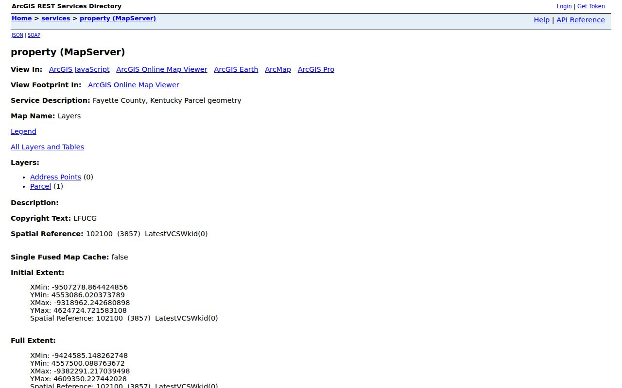
The image confirms the parcel and address-point service used to move from a street label to a stable PVANUM. Use that identifier in the PVA system, where owner information belongs.
- Parcel
- A mapped tract or tax unit with its own identifier.
- Situs address
- The physical location of the property, distinct from an owner's mailing address.
- Plat
- A recorded drawing that lays out lots, blocks, easements, and subdivision lines.
- Criss-cross directory
- A directory arranged by street or address instead of only by surname.
Fayette Records Indexed by Address
No Fayette County street directory source answers every question. The parcel roll is current and ownership-focused. Deeds establish recorded parties and transfers. City records document a project or order. Historical directories list selected occupants or subscribers. The coverage table keeps those roles clear.
| Address record | Keeper | What it can establish | Access channel |
|---|---|---|---|
| Property assessment | Fayette PVA | Tax-date owner, situs, parcel, values, sales | qPublic, PVA office, phone |
| Parcel geometry | LFUCG GIS | Street segment, lot shape, PVANUM, unit | REST map service and MapIt |
| Deeds, liens, plats | Fayette County Clerk | Recorded parties, legal description, chronology | Fayette Deeds, Room 132, mail copy request |
| Permits and final orders | LFUCG | Project, applicant, inspection, order, lien event | One-Stop, AgencyCounter, city request |
| Voter information | Kentucky elections officials | A known person's current registration | VIC or regulated SBE-84 request |
| Historic address listings | Lexington Public Library | Listed occupant, subscriber, or business by year | Digital archives, Kentucky Room, staff request |
When the web trail ends, take a locator to the custodian. The Clerk can work from book/page, instrument, party, parcel, or a narrow date span. LFUCG's Records Center can route a specific city series. The Kentucky Room can check physical material not represented in its digital archive.
Note: A free index entry is a finding aid; request the recorded image or certified copy when the document itself must be verified.
Follow Fayette Deeds Along Streets
Fayette Deeds separates street number, direction, street name, street type, subdivision, lot, and block. Test those pieces rather than relying on one long modern label. Start with the book/page from the PVA card, confirm the legal description, and then search the current seller as a prior buyer. Deed, correction deed, and plat records are the core title path; mortgages and releases add context but are not transfers by themselves.
The live index also accepts grantor, grantee, instrument, date, consideration, and legal-description criteria, and a query is capped at 1,000 results. That numeric limit matters on common names and long roads. Narrow first by instrument or date. Older material reaches non-indexed deed, survey, tax, will, and order books, so an empty portal result is not proof that a record never existed.
For copies, the Fayette County Clerk's Land Records Division is in Room 132 at 162 East Main Street. A copy request can be mailed, while in-person staff can use a book/page or other exact locator. The Clerk's open-records policy adds written and electronic request channels for a clearly described record.
Fayette Street Work and Orders
LFUCG building permits, One-Stop, and AgencyCounter can add project and certificate activity to an address chain. Code Enforcement handles property conditions and inspections, while the city's final-orders page covers orders that may lead to a property lien. These records date official action. An applicant or contact is not automatically an owner or resident.
The interactive planning and final-order tools did not expose stable field inventories during unattended research. Search the exact address first, then use an LFUCG open-records request for a defined project, case, date span, or final order. The Records Center and Archives at 1306 Versailles Road is the fallback for city record series, with phone and in-person access during its posted weekday schedule.
Voters Are Not a Street Roster
The Kentucky Voter Information Center confirms a known person using legal first name, legal last name, and date of birth, with the last four digits of a Social Security number optional. It returns current registration, polling place, and absentee status. It does not browse everyone on a Fayette County street.
A separate SBE-84 request can supply authorized street, ZIP, precinct, or household-label formats. The requester signs a use oath, pays the stated format fee, and accepts statutory limits under Kentucky election law. Social Security numbers are redacted, and Safe at Home physical addresses are protected. Treat voter data as regulated confirmation, not an open address directory.
Older Lexington Streets by Address
Lexington Public Library's Kentucky Room holds city and county directories, maps, newspapers, yearbooks, and selected census material. Digitized runs include city directories from 1864-65, a 1912 rural directory, telephone books, a 1956 streets and subdivisions volume, and a 1971 farm directory. These are selected runs, not a claim that every year survives.
Old entries may use h for home, bds for boarding, a spouse in parentheses, an occupation, or historic editorial marks. A telephone book lists subscribers, not all occupants. When the task becomes a full collection study, the Fayette County city directory page explains the volumes and entry formats in depth.
Do not force a modern number onto an older page. Research found no official complete street-renumbering schedule to cite. Preserve the printed form, then compare plats, deed descriptions, directory street sections, census geography, and Sanborn maps before deciding two labels refer to the same place.
Fayette Addresses Cross Civic Lines
Lexington and Fayette County merged government in 1974 after the 1972 charter vote. That history explains why older sources may say Lexington or Fayette while current pages use LFUCG. It does not make every boundary identical. A postal ZIP, parcel, neighborhood association, precinct, council district, and watershed can cross or nest in different ways.
MapIt connects one address to civic layers, while the LFUCG ZIP service supplies a separate polygon. The deed's legal description remains the title key. For the street directory, store each label in its own field instead of treating one as a substitute for the rest.
Limits of Fayette Street Records
A PVA card names owners, not every person in a building. GIS shows geometry without owner names. A deed records parties to an instrument. Private utility, delivery, and association membership lists were not found as public Fayette datasets, and driver-address information is restricted. Juvenile or sealed cases, restricted vital records, redacted police files, and Safe at Home physical addresses also stay outside an ordinary street directory search.
Commercial address compilations may merge old and new data without showing the source date. Official rolls are narrower, but each has a named custodian and a stated purpose. Check the underlying record, preserve its date, and avoid turning absence from one index into a claim about a household.
Lawful use. Use Fayette County address records for family research, property history, civic curiosity, and personal safety. Never use them to stalk, harass, intimidate, or harm anyone.